Map - Palotina

Palotina
Palotina is a Brazilian municipality in western Paraná state, located around 60 kilometers from the border with Paraguay.

The population is 32,121 inhabitants, as of the 2020 estimate. Owing to highly fertile land, the city is a flourishing agricultural hub and a base for two major agricultural companies: C. Vale and I. Rieddi. Another highlight of Palotina is the campus of the Federal University of Paraná (UFPR). There is also one private university, the UESPAR (União de Ensino Superior do Paraná).

The municipality contains the 385 ha São Camilo State Park, a conservation unit originally created as a biological reserve in 1990.
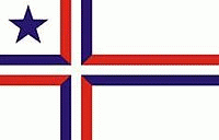
 
Map - Palotina
Map
Google Earth - Map - Palotina
Google Earth
Openstreetmap - Map - Palotina
Openstreetmap
Map - Palotina - Esri.WorldImagery
Esri.WorldImagery
Map - Palotina - Esri.WorldStreetMap
Esri.WorldStreetMap
Map - Palotina - OpenStreetMap.Mapnik
OpenStreetMap.Mapnik
Map - Palotina - OpenStreetMap.HOT
OpenStreetMap.HOT
Map - Palotina - OpenTopoMap
OpenTopoMap
Map - Palotina - CartoDB.Positron
CartoDB.Positron
Map - Palotina - CartoDB.Voyager
CartoDB.Voyager
Map - Palotina - OpenMapSurfer.Roads
OpenMapSurfer.Roads
Map - Palotina - Esri.WorldTopoMap
Esri.WorldTopoMap
Map - Palotina - Stamen.TonerLite
Stamen.TonerLite
Country - Brazil
Currency / Language  
ISO Currency Symbol Significant figures
BRL Brazilian real R$ 2
Neighbourhood - Country  
  •  Argentina 
  •  Bolivia 
  •  Colombia 
  •  French Guiana 
  •  Guyana 
  •  Paraguay 
  •  Peru 
  •  Suriname 
  •  Uruguay 
  •  Venezuela 
Administrative Subdivision
City, Village,...